Cost: $0
Size: 313.00 kB
Release date: Nov 14 2020
Platform: Win2000,WinXP,Win7 x32,Win7 x64,Windows 8,Windows 10,WinServer,WinOther,WinVista,WinVista x64
Publisher’s Site: https://ozgis.sourceforge.io
Publisher’s Product Page: https://sourceforge.net/projects/ozgis/
Country: Australia
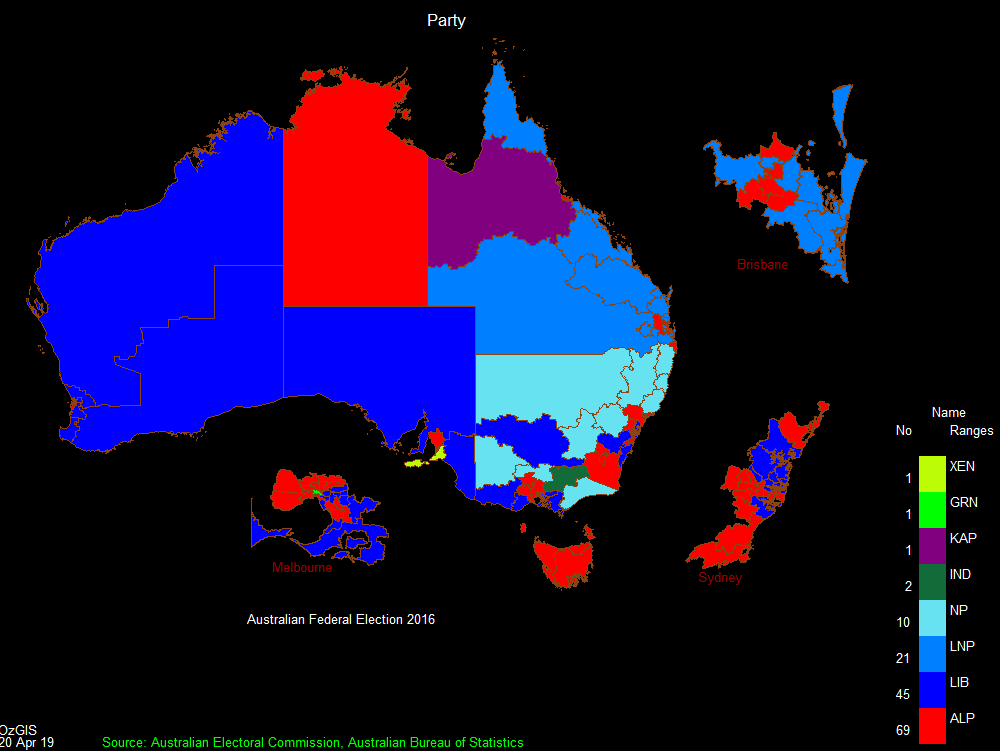

referenced data. About 150 menus provide an enormous range of options for:
. importing data from databases, spreadsheets and Geographic Information
Systems (GISs) or downloaded from Census Bureaux or mapping agencies.
. processing data in preparation for display and analysis
. display of data as several different types of maps and diagrams.
. facilities to analyse displayed data and to manipulate the maps.
. Special support for site catchment analysis, location / allocation and
territory assignment.
The system can be used to analyze socio-economic and demographic data produced
by censuses and surveys and to support management decisions associated with for
example marketing, sales, site and personnel location, and advertising. Other
spatial data such as environmental data can be displayed.
Search for OzGIS on Youtube for tutorial / demonstration videos.
 <
<